
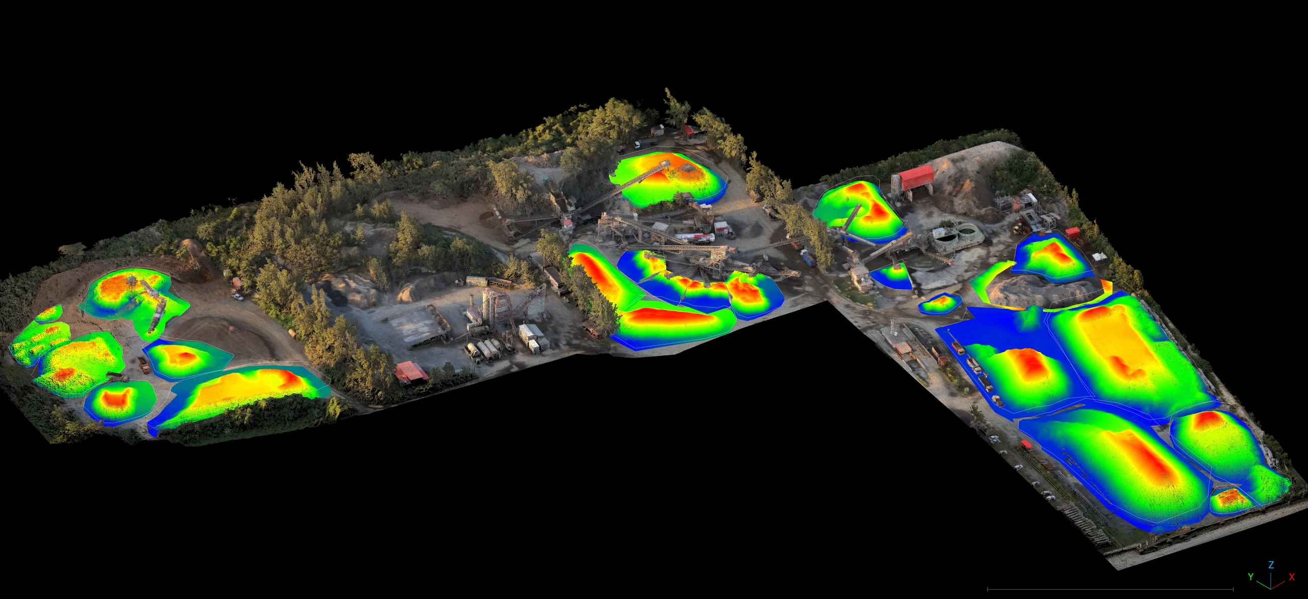
Stockpile volume is a number that ends up in a financial statement, so the method behind it matters as much as the figure. Ours is stated on every report: the base surface used, the interpolation method, and the accuracy band.
Repeatability is the whole point
A single volume is an estimate. A series of volumes, captured the same way against the same base surface, is an inventory record. We hold the base surface between visits so period-on-period movement reflects material moving, not the method changing.
Indoor and outdoor
Covered sheds are where drone-based methods fail and where walk-through scanning is strongest — no GNSS dependency, no line-of-sight to the sky, full coverage right up to the shed walls where material is hardest to estimate by eye.
What the report shows
Each cycle you receive total volume, per-pile breakdown, the change since the last capture, and a heat map of where on the pile that change occurred. It takes a conversation about “roughly how much is in there” and replaces it with a figure and its provenance.