Clarity Consulting

109,374,045 individual measurements across 2 published datasets

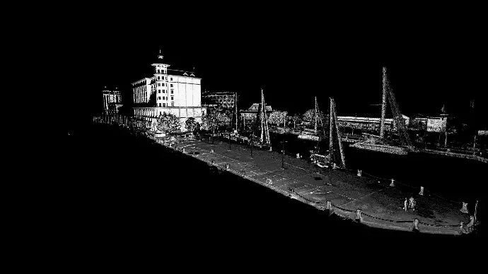
Intensity-shaded point cloud of the Caudan Waterfront quay, showing the quay deck, bollards, moored yachts and the buildings behind

Caudan Waterfront quay assessment

A damaged quay captured on foot at high density, giving engineers a measurable above-water plan to design repairs against.

Capture method
Survey walk-through
Visualisation
Intensity returns
Point count
52,895,591
Read the capture notes
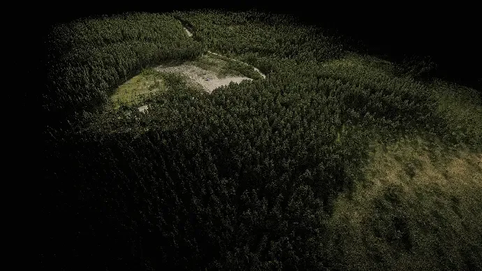
Colourised point cloud of a dense conifer plantation seen from above, with a cleared area and access track visible through the canopy

Conifer plantation canopy survey

A UAV capture returning both canopy structure and the ground beneath it, from a single flight over closed-canopy plantation.

Capture method
UAV (drone)
Visualisation
RGB (colourised)
Point count
56,478,454
Read the capture notes

Want to see data from a site like yours?

We can usually share something comparable in scale or setting. Tell us what you are planning and we will send the closest example we are free to show.