
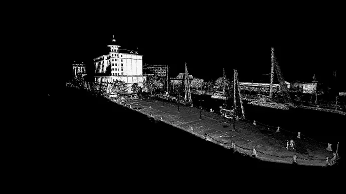
The quay at Caudan Waterfront had sustained structural damage, and the repair design needed dimensional certainty about the structure as it stood — not as it was originally built.
Why walk-through capture
The site is a live, public waterfront. A tripod-based static survey would have meant closing sections of the quay for hours at a time, and a UAV capture could not have reached beneath the deck edge or under the mooring furniture. Carrying a SLAM scanner along the quay let us capture the full length in a single pass, around the public, without closing anything.
Rendered as intensity
This dataset is shown as intensity returns rather than RGB, and that is a deliberate choice rather than a limitation. Intensity records how strongly each surface reflected the laser, which makes surface condition legible — the distinction between sound concrete, spalled concrete and staining reads clearly in a way it does not in a colour photograph taken in harsh sunlight.
What it produced
- An above-water plan of the quay at full length, to survey accuracy
- Sections at any chainage, extracted on demand as the design developed
- A permanent baseline for future condition monitoring — the same quay can be rescanned and differenced to quantify movement since 2024