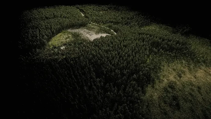
Closed-canopy plantation is the case that separates LiDAR from photogrammetry. From the air, a camera sees canopy and nothing else. Laser pulses find the gaps.
One flight, two surfaces
This capture returns a canopy surface and a bare-earth surface from the same dataset. Classifying the returns separates the two, which is what makes it possible to measure terrain under mature forest without cutting a single line of sight by hand.
What the data supports
- Topographic survey beneath the canopy, for access tracks, drainage and extraction planning
- Canopy height model across the whole block rather than at sample plots
- Stocking and growth — rescan the same block later and the difference is measured growth, not an estimate
Rendered in RGB
Unlike the Caudan dataset, this cloud is colourised from imagery captured alongside the scan. For vegetation work, colour carries real information: species differences, stress and canopy gaps are all easier to read when the points carry their true colour.